Introduction
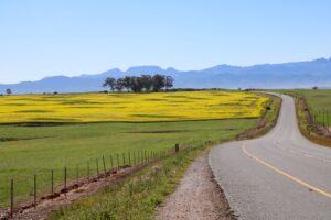
It is essential to have accurate maps in any farming enterprise, particularly if you are planning to do precision farming.
Other times when you will be grateful to have maps are when you are:
- planning aerial crop-spraying
- determining the potential of land
- applying pesticides
- ordering seed and fertiliser
- wishing to insure your crops hiring or renting land
- when planning time periods for grazing
- having overhead installations done e.g. power cables
- estimating crop yields
- determining crop suitability
- searching for breeding stock
Geographical Information Systems (GIS), a system of synthesising information, uses maps and ortho rectified photography as inputs to generate data (ordinary photographs can lead to inaccuracies and GIS is about measurement). Other systems of mapping include the use of satellites and Topo-cadastral mapping.
See also the “Drones”, “Digital agriculture” and “Precision farming” pages.
Role players
Business Listings
The following business listings are provided for informational purposes only. Agribook does not endorse or guarantee any of the listed businesses, their products, or services.
Council for Geoscience (CGS)
www.geoscience.org.za
Geological Society of South Africa
gwd.org.za
Collective Analytix
www.collectiveanalytix.com
ESRI South Africa
www.esri-southafrica.com
GeoSpace International
www.geospace.co.za
GeoTerraImage
geoterraimage.com
GISCOE
www.giscoe.com
Land Resources International
www.lri.co.za
MAPCO
www.mapcosa.co.za
Optron
optron.com
Technifarm
www.technifarm.co.za
Terragis
www.terragis.co.za
The Surveyor
thesurveyor.co.za
TNH Wildlife
www.tnhwildlife.com
Woolpert Africa
woolpert.com
Geo-Information Society of South Africa (GISSA)
gissa.org.za
Africa Land-Use Training (ALUT)
www.alut.co.za
Agricultural Research Council (ARC) – Soil, Climate and Water (ARC-SCW)
www.arc.agric.za
Cape EAPrac
www.cape-eaprac.co.za
PCI Agricultural Services
www.pciagri.com
University of Fort Hare (UFH) – Chemical and Earth Sciences
www.ufh.ac.za
Further reference:
Companies
- Your nearest agribusiness (e.g. VKB or OVK) will be involved in mapping and Geographical Information System, helping you to access farm and regional maps. Find contact details on the “Agribusiness” page.
- See the “Drones” page. One function of drones is mapping the layout of lands and property.
Parastatal and government
- Department of Agriculture Find the Spatial Planning and Land Use Management pages at www.nda.gov.za. Earth observation technologies and geographic information systems, spatial modelling and scenario planning are all listed as “Key Strategic Areas and thrusts” in DALRRD’s National Agricultural Research and Development Strategy.
- Department of Water and Sanitation (DWS) www.dws.gov.za Ground water maps. A list of contacts can be found on the website
- Accurate records based on the soil type, rainfall, typography and climate on individual farms are kept by Provincial Departments of Agriculture.
Training
- Some of the Agricultural Colleges do short course training in map reading along with practical exercises involved with the different lectures. Find their details in the “Agricultural education and training” chapter.
- The Universities cover mapping and Geographic Information Systems in course work. Find their details in the “Agricultural education and training” chapter. At the University of KwaZulu-Natal (UKZN), for example, has a GIS and Earth Observation group housed in the Geography Department. University of Fort Hare (UFH) covers this in Chemical and Earth Sciences
Websites and publications
Visit the websites listed earlier on this page.
- The Council for Geosciences (CGS) hosts the largest Geological Library and Information Service in Africa, “which continuously strives to improve its coverage of African geology”, in the form of books, journals and maps. Information products is made available, both in standard analog and electronic formats and Internet solutions for optimal information access are being developed.
- Spot your farm – or anywhere else – from outer space: visit www.google.co.za/maps or https://earth.google.com
- Read about the RapidEye five-satellite, geospatial information system at www.planet.com
- www.ppgis.net – Open Forum on Participatory Geographic Information Systems and Technologies
- https://ivis.africa allows viewers to gain an aerial view of land and to zoom in digitally
- USGS Global Visualization Viewer (GloVis) – https://glovis.usgs.gov/