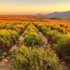
Photo by Johny Goerend on Unsplash
Also see the “Digital agriculture”, “Drones”, “Mapping” and “Agricultural media and ICT” pages.
Introduction
Precision farming utilises six ultra-modern technologies:
- Global Positioning Systems (GPS), which provides a navigation system to establish a position of a tractor or combine anywhere in a land within less than 2 meters on a latitude-longitude grid overlay.
- Geographic Information Systems (GIS) – GIS Computers capture, manage and analyse spatial data related to crop productivity and field inputs.
- Variable Rate Technology (VRT), which provides “on-the-fly” control of field inputs.
- Optical satellite imagery – provides real-time monitoring of crop development and anomalies due to variation in soil potential, physical or climatic variables, pest and diseases, or nutrient deficiencies.
- Satellite Imagery and Aerial Imagery
- Near Infra Red (NIR) Ortho rectified Imagery. This is becoming a very important technology – initially with timber and wine farmers but spreading to all farmers.
Information derived from these technologies allows farmers to:
- apply inputs such as fertilisers and seed at variable rates exactly where they are needed
- make more efficient use of these inputs
Precision Farming promotes good stewardship of the land for future generations, and preserves its potential for multiple uses.
At a time when the farmer is faced by decreasing profit margins and changing climates, precision farming is a smart way to farm.
"Precision Agriculture Solutions" (Inter-American Development Bank, 2017) provides an introduction ...
Autonomous tractors and robots
See the “Digital agriculture” page.
Role players
Business Listings
The following business listings are provided for informational purposes only. Agribook does not endorse or guarantee any of the listed businesses, their products, or services.
Aerobotics
www.aerobotics.com
AFGRI Agri Services precision
www.afgri.co.za
AfricaWeather
www.africaweather.com
Agri-Enviro Solutions (AES)
www.aesol.co.za
AgriBots
agribots.co.za
Agrigel
www.agrigel.co.za
Agrilux soils
www.agrilux.co.za
AgriScan
www.agriscan.co.za
Case IH
www.caseih.co.za
Cerealis Precision
www.cerealis.co.za
CNH Industrial
www.cnhindustrial.com
Crop Systems
www.cropsystems.co.za
DFM Technologies
dfmtechnologies.co.za
E-Farming Solutions
www.efarming.co.za
Electrolee
www.electrolee.co.za
ESRI South Africa
www.esri-southafrica.com
Eucatech
euca.co.za
Farmquip SA
farmquipsa.com
GISCOE
www.giscoe.com
HEXAGON
hexagon.com
Integrated Value Information System (IVIS)
ivis.africa
JACTO
jacto.com
John Deere
www.deere.africa
Land Resources International
www.lri.co.za
Lantek SA Precision Farming
www.lanteksa.co.za
Lemken SA
lemken.com
MAPCO
www.mapcosa.co.za
MiX Telematics
mixtelematics.com
New Holland – Precision Land Management
www.newhollandplm.com
neXgro
www.nexgro.co.za
NWK Ltd
www.nwk.co.za
Omnia
www.omnia.co.za
OPTRON
www.optron.com
PACSys
pacsys.co.za
Quantum Field Services
www.qtfs.co.za
Ronin Systems Solutions
www.thisisronin.com
Swift Geospatial
swiftgeospatial.solutions
Technifarm
www.technifarm.co.za
Teejet Technologies South Africa
www.teejet.com
TELUS Agriculture
www.telus.com
TerraClim
www.terraclim.co.za
The Awareness Company
awarenesscompany.co.za
TOPCON
www.topconpositioning.com
Vantage SSA
www.vantage-ssa.com
Agricultural Research Council (ARC) – Agricultural Engineering (ARC-AE)
www.arc.agric.za
Agrilux soils
www.agrilux.co.za
PACSys
pacsys.co.za
Visual Viticulture
visualviticulture.co.za
Further reference:
Training and research
- Companies involved supply training in their products. Find their details under “Companies”.
- The Agricultural Colleges, universities and short course providers listed on the “Agricultural education and training” page are involved with precision farming.
Other role players
- Climate monitoring systems can halve the use of water for farmers. Find companies who offer weather services in “Weather and climate”.
- South African National Space Agency (Sansa) – www.sansa.org.za
- Read about the Enhancing Food Security in African AgriCultural Systems with the support of Remote Sensing (AfriCultuReS) project on the website or at www.africultures.eu.
Websites and publications
Refer to the websites listed earlier on this page. See also the many articles on the “Digital Agriculture” and “Drones” pages.
- Read our blogs like “Advanced food processing technologies could make the food industry more sustainable“, “Harnessing the power of agritech to help SA’s smallholder farmers” and “Electronic management for fine wines” at www.agribook.co.za/blog.
- Ntshabele B. 2025, November 24. “Alignment To Bolster Industry Growth.”Agribook. Available at www.agribook.co.za/alignment-to-bolster-industry-growth
- Truter K. 2025, May 16. “Agricultural technology-hype vs on-farm reality: Are we chasing the right solutions?” LinkedIn. Available at www.linkedin.com/pulse/agricultural-technology-hype-vs-on-farm-reality-we-chasing-truter-jhcnf/
- McCormick. 2021, January 27. “Precision farming: what is it and what benefits does it offer?” Available at www.mccormick.it/as/precision-farming/
- Uys, G. 2018, June 21. “Pursuing soil health precisely”. Farmer’s Weekly. Available at www.farmersweekly.co.za/crops/field-crops/pursuing-soil-health-precisely
- Erasmus, D. 2018, April 13. “Will technology end hunger?” Farmer’s Weekly. Available at www.farmersweekly.co.za/opinion/blog/letter-from-the-editor/will-technology-end-hunger/